| Criterios |
Simulaciones con Escenarios Reales |
Simulaciones con Escenarios Ficticios |
| Propósito |
Enseñar y capacitar en análisis y resolución de problemas reales utilizando datos geoespaciales verídicos. |
Desarrollar habilidades de pensamiento crítico y resolución de problemas mediante el análisis de escenarios hipotéticos. |
| Base de datos |
Datos reales provenientes de satélites, censos, encuestas, base de datos de instituciones de gobierno y otras fuentes de información GIS. |
Datos ficticios generados a partir de entornos imaginarios o adaptaciones creativas de datos reales. |
| Productos |
Mapas detallados, modelos en 3D con alta precisión, análisis espacial complejo, e informes analíticos. |
Mapas estilizados, entornos 3D creativos, escenarios interactivos, y líneas de tiempo visuales. |
| Precisión |
Alta precisión, bajo margen de error, para reflejar situaciones y problemas del mundo real. |
Menor precisión, en dependencia del volumen de datos ficticios con que se cuente. |
| Herramientas de visualización |
Dashboards, storymaps, gráficos y narrativas visuales que facilitan la comprensión de escenarios complejos. |
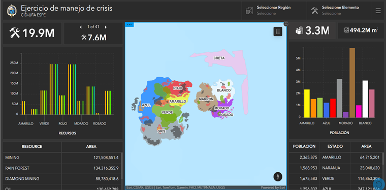
Dashboards, storymaps, gráficos y narrativas visuales adaptados para representar información ficticia para facilitar la comprensión y toma de decisiones en las simulaciones. |
| Tecnologías complementarias |
Algunos ejemplos: GPS, imágenes satelitales, drones, software de análisis de datos y la IA para el análisis de patrones geoespaciales. |
Algunos ejemplos: motores de video juegos, software de animación y diseño gráfico, y la IA limitada al análisis de las interacciones de los actores de la simulación. |
| Ventajas |
Permite la identificación de vulnerabilidades, la evaluación de amenazas reales, y la planificación de estrategias de mitigación y respuesta. Constituye una buena herramienta para la toma de decisiones en entornos reales. |
Permite identificar los principales retos en el proceso de toma de decisiones al generar entornos neutros, facilitando la comprensión más objetiva de las posibilidades de acción y respuesta ante diferentes escenarios. |
| Desafíos |
Requiere datos precisos y actualizados pudiendo ser complejo integrar múltiples fuentes de información. |
La creación de datos ficticios desde cero puede ser laboriosa, requiriendo en algunos casos habilidades avanzadas en GIS, diseño gráfico y programación. |
| Aplicaciones en Defensa |
Capacitación y facilitación de operaciones conjuntas, integración de datos de inteligencia y visualización del entorno operativo en tiempo real para una mejor toma de decisiones a nivel estratégico. |
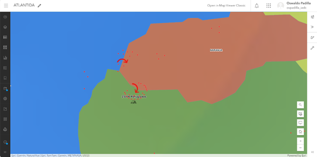
Simulaciones que permiten a los participantes tomar decisiones basadas en escenarios ficticios, mejorando la preparación y reflexión estratégica. Es recomendable para ambientes internacionales. |

 Geospatial Tools in the Generation of Fictitious Scenarios for Crisis Simulation Exercises at the Inter-American Defense College
 Thumbnail
 Thumbnail
 Thumbnail


